OfflineMaps provides you with access to a diverse selection of maps, ensuring you can explore and navigate without any interruptions. Here’s why you should consider using All-In-One OfflineMaps:
No advertisements ~ No data sharing & monetization ~ No analytics ~ No third-party libraries
Tired of waiting for maps to load? With All-In-One OfflineMaps, once a map is displayed, it is stored locally and remains accessible instantly, even without an internet connection.
• Seeking more than just road maps? You'll find an array of options tailored to your needs;
• Frequently visit areas with poor network coverage? No worries—your maps will stay available;
• Traveling abroad? Say goodbye to getting lost;
• Concerned about your data allowance? OfflineMaps will help reduce your data usage.
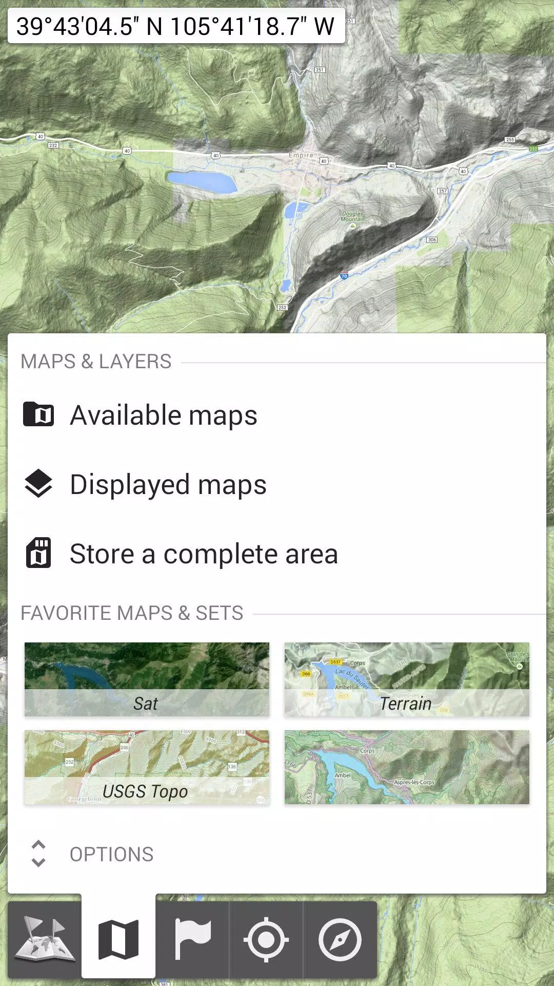
★★ Maps ★★
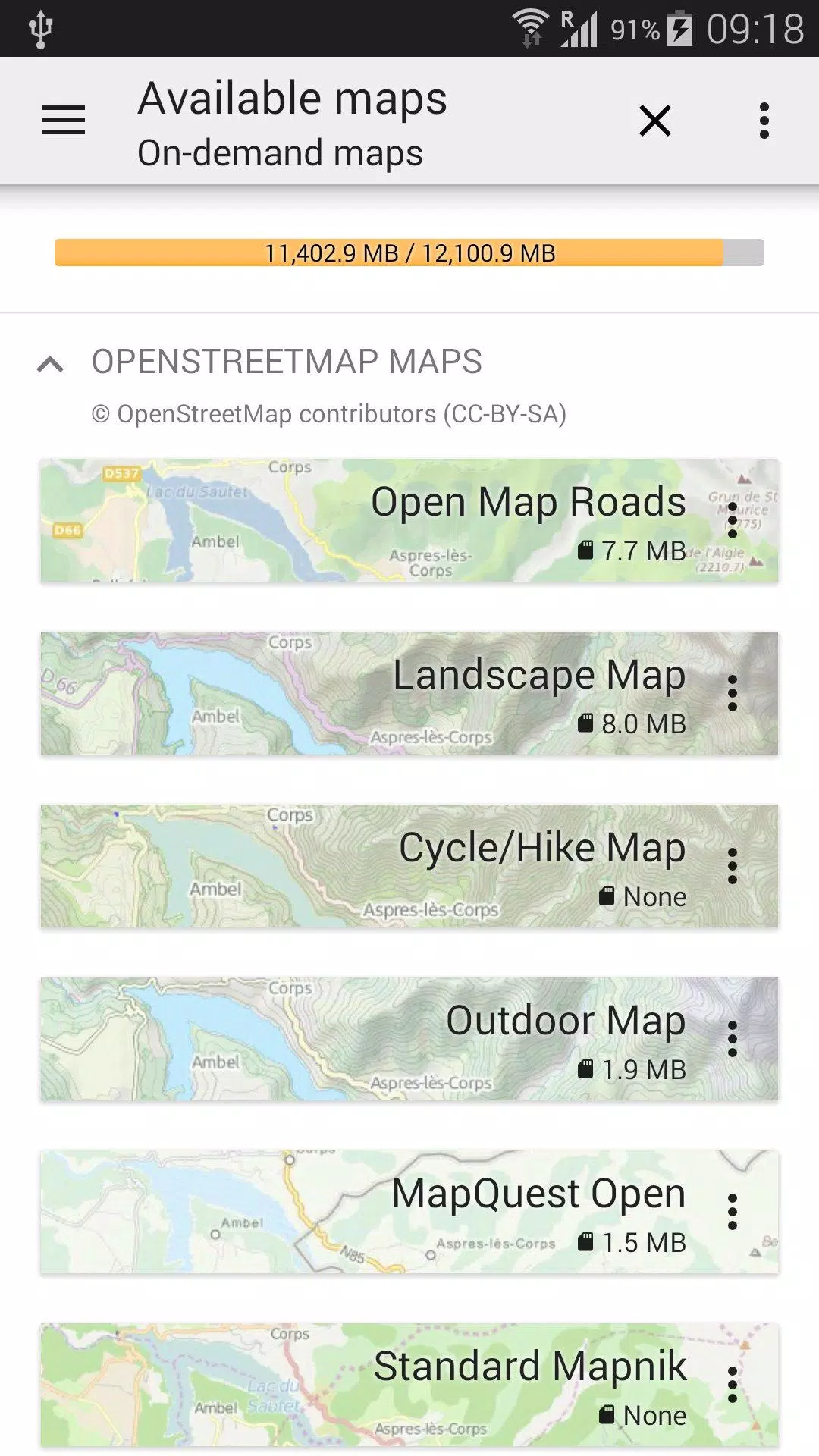
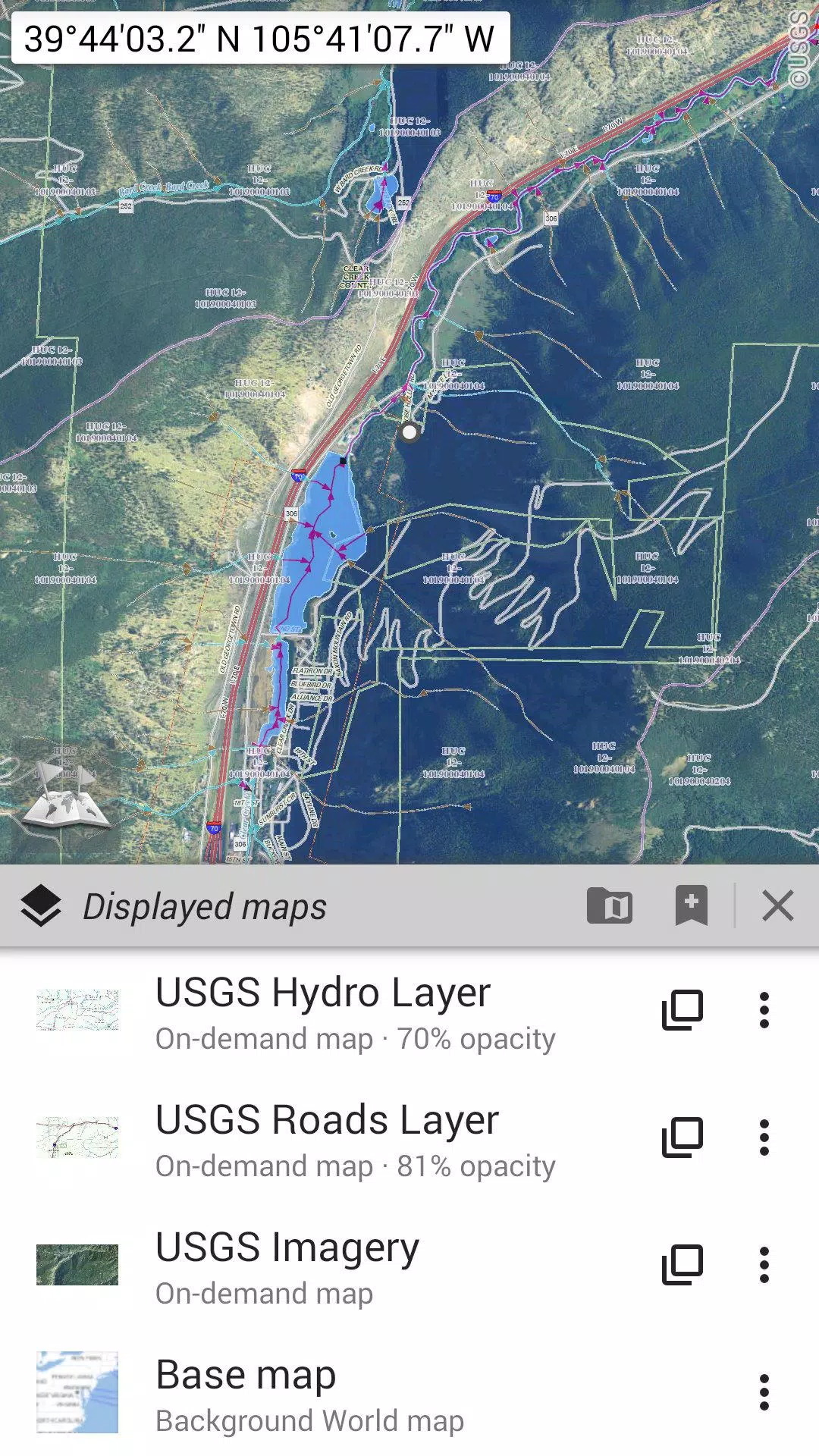
Explore a vast collection of maps, ranging from traditional road maps to detailed topographic maps, aerial (satellite) views, and customizable layers: OpenStreetMap (Roads, Topo), USGS National Map (High-resolution topo, Aerial imagery), and Worldwide Military Soviet topo maps, among others.
• Seamlessly layer multiple maps with adjustable opacity;
• Quickly select and save large areas with just a few clicks;
• Easily manage your stored map data and delete it when necessary.
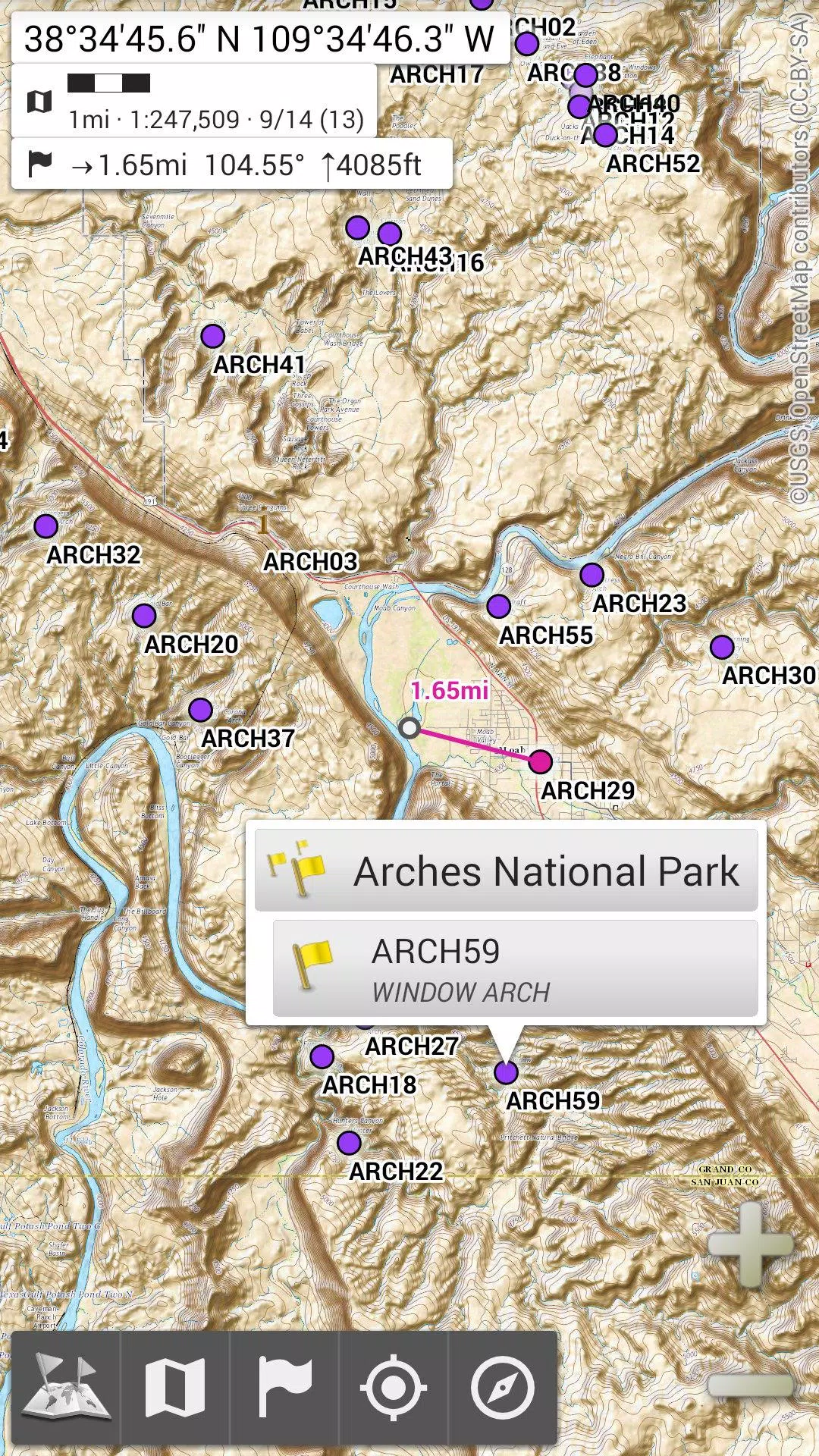
★★ Display, Store, and Retrieve Unlimited Placemarks ★★
Enhance your maps by adding various elements like waypoints, icons, routes, areas, and tracks.
Effortlessly manage these using the robust SD-Card Placemarks Explorer.
★★ On-Map GPS Location & Orientation ★★
View your precise location and direction directly on the map, which can be rotated to align with your real-world orientation (dependent on your device's capabilities).
Save battery life by easily toggling the GPS on and off.
Additional Features Include:
• Flexible distance units: metric, imperial, and hybrid;
• Support for multiple GPS coordinate systems, including Latitude/Longitude and grid formats like UTM, MGRS, USNG, OSGB Grid, Irish Grid, Swiss Grid, Lambert Grids, DFCI Grid, QTH Maidenhead Locator System, and more;
• Import capabilities for hundreds of coordinate formats from https://www.spatialreference.org;
• On-map grid display;
• Full-screen map view;
• Multi-touch zoom functionality;
• And much more.
★★ Need More? ★★
For the ultimate outdoor experience, consider AlpineQuest Off-Road Explorer, an advanced version built on All-In-One OfflineMaps, featuring a powerful GPS Track Recorder and additional features: https://www.alpinequest.net/google-play