Super Terrain: A Comprehensive Mapping and Navigation App
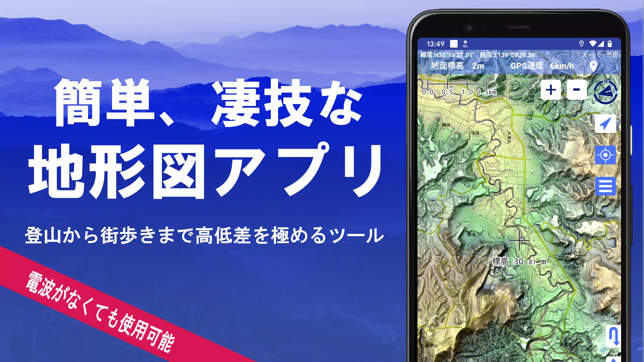
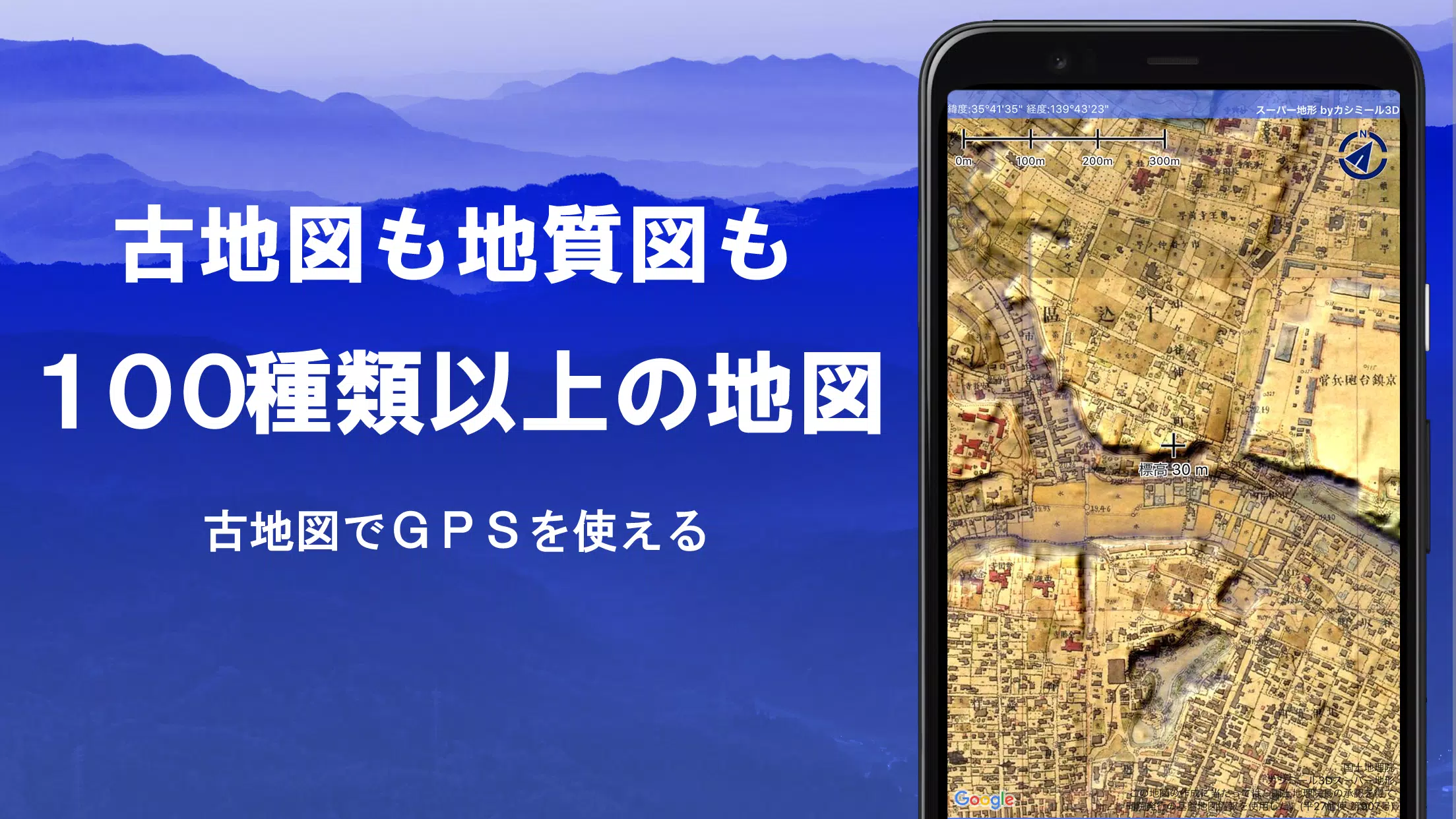
Super Terrain offers an unparalleled mapping experience, boasting over 100 map types, including those from the Geospatial Information Authority of Japan (GSI), such as topographic, geological, and historical maps. This powerful app utilizes unique technology to create "super terrain data," maximizing elevation detail for activities ranging from urban exploration to challenging mountain climbs. Awarded the 2018 Japan Cartographic Society Award for Best Work, Super Terrain is a robust tool for outdoor enthusiasts and professionals alike.
Key Features:
-
Extensive Map Library: Access a vast collection of maps, including GSI maps, hazard maps, and the app's proprietary super terrain data (5-day free trial). Aerial photographs, though not universally available across all time periods, offer substantial coverage for "Latest" and "around 1974" imagery.
-
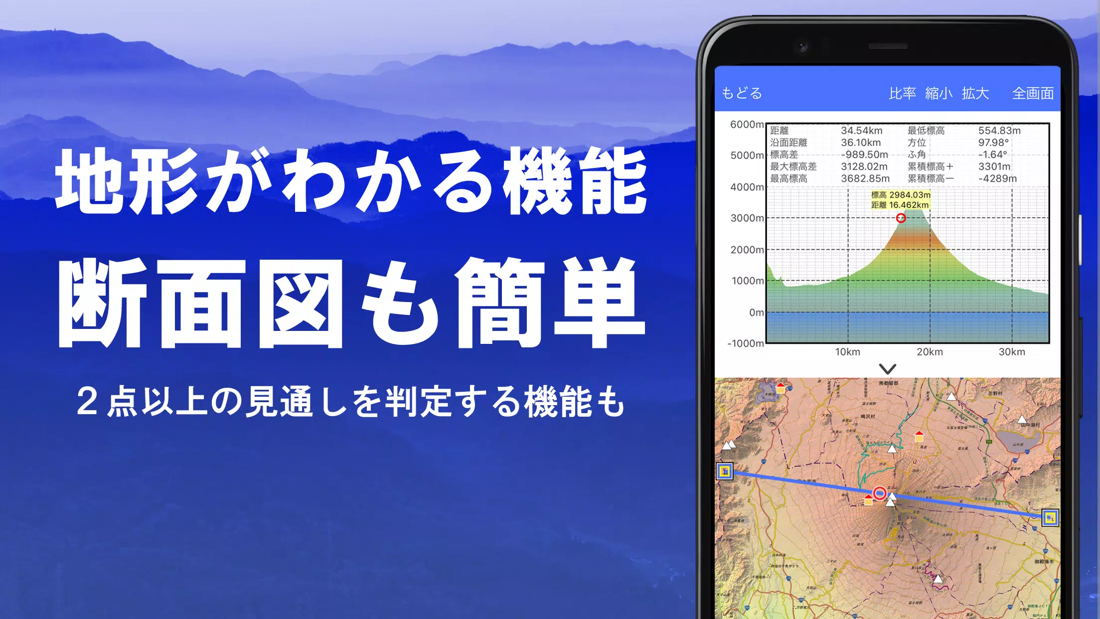
Advanced Terrain Analysis: Create precise cross-sections, incorporating building data where available, and utilize the visibility determination function for planning routes, assessing radio transmission, or general observation. Earth's curvature and atmospheric conditions are factored into these calculations.
-
Immersive 360° Panoramic Views: Explore stunning panoramic views, identify mountains, and visualize the sun and moon's positions, including moon phases – ideal for tracking celestial events like Diamond Fuji.
-
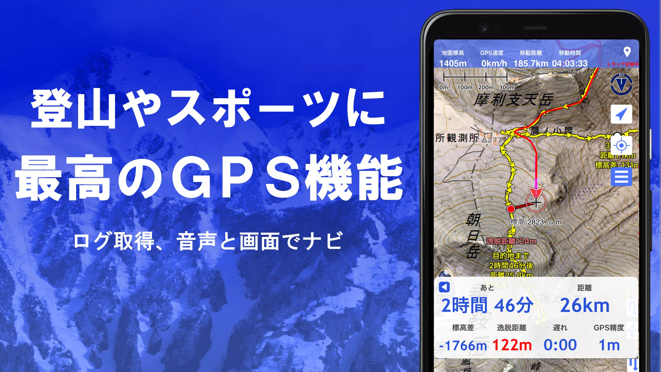
Robust GPS Functionality: Record detailed tracks (GPX import/export supported), navigate using audio cues (Track Navi), and receive point alerts. High-precision GPS tracking is optimized for demanding outdoor conditions. The app also allows photo association with specific points and offers route and point navigation options. Track playback features synchronized photo display based on recording times.
-
Offline Capabilities: Download maps in bulk for offline use, ensuring uninterrupted access even in remote areas with limited or no signal. A map cache function further enhances offline functionality.
-
Data Management & Editing: Manage GPS data (points, routes, tracks) with a user-friendly folder system and tree view. Create, edit, and import/export GPX files. Draw shapes directly on the map and edit GeoJSON data.
-
Additional Features: Includes elevation palette customization, MGRS/UTM grid display, map printing/PDF output, dark theme support, and a backup/restore function using Google Drive. The app also offers compatibility with custom maps and other applications through various data formats (GPX, KML, GDB).
Pricing & In-App Purchases:
A free 5-day trial is available. After the trial, access to certain features and maps requires an annual subscription of 780 yen. This subscription also increases the number of results for place name searches. Automatic renewal can be managed through Google Play. Prices are subject to change.
Disclaimer: The developers are not responsible for any consequences arising from the application's use. Continuous GPS use may drain battery life; users are advised to take necessary precautions, especially in emergency situations. Some devices may experience track recording interruptions due to power-saving features. Refer to the manual for detailed instructions and troubleshooting. A navigation guide PDF is available at https://www.kashmir3d.com/online/superdemapp/superdem_navi.pdf.