Introducing the definitive HEMAV app, designed to help you monitor your fields directly from your mobile device. This powerful tool integrates the advanced capabilities of HEMAV LAYERS, which combines Artificial Intelligence with drone and satellite technology to deliver comprehensive agronomic reports and recommendations.
With the HEMAV app, you can:
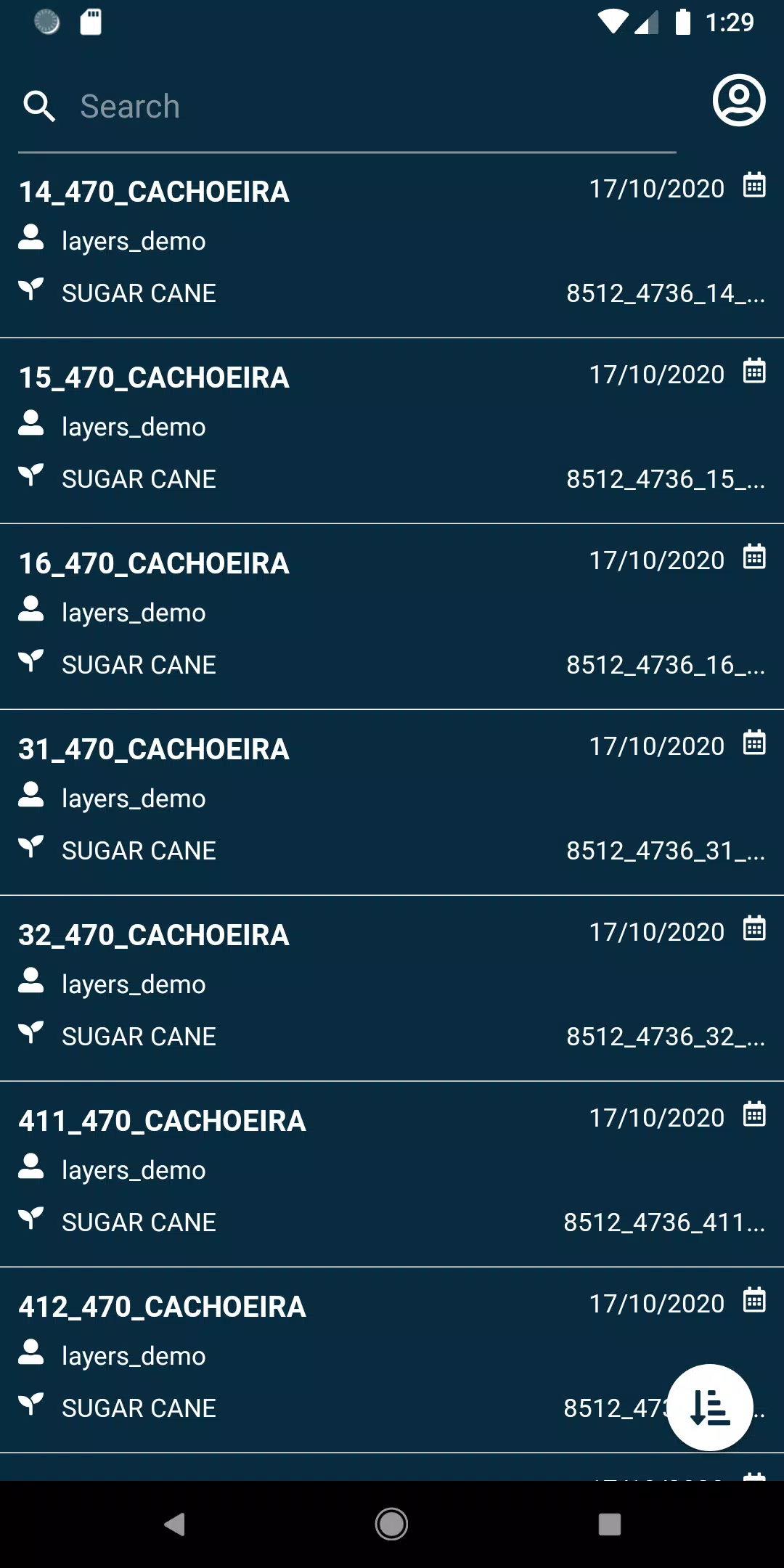
- View your fields effortlessly, ensuring you stay on top of your agricultural operations.
- Search through your fields using a wide range of filters to pinpoint exactly what you need.
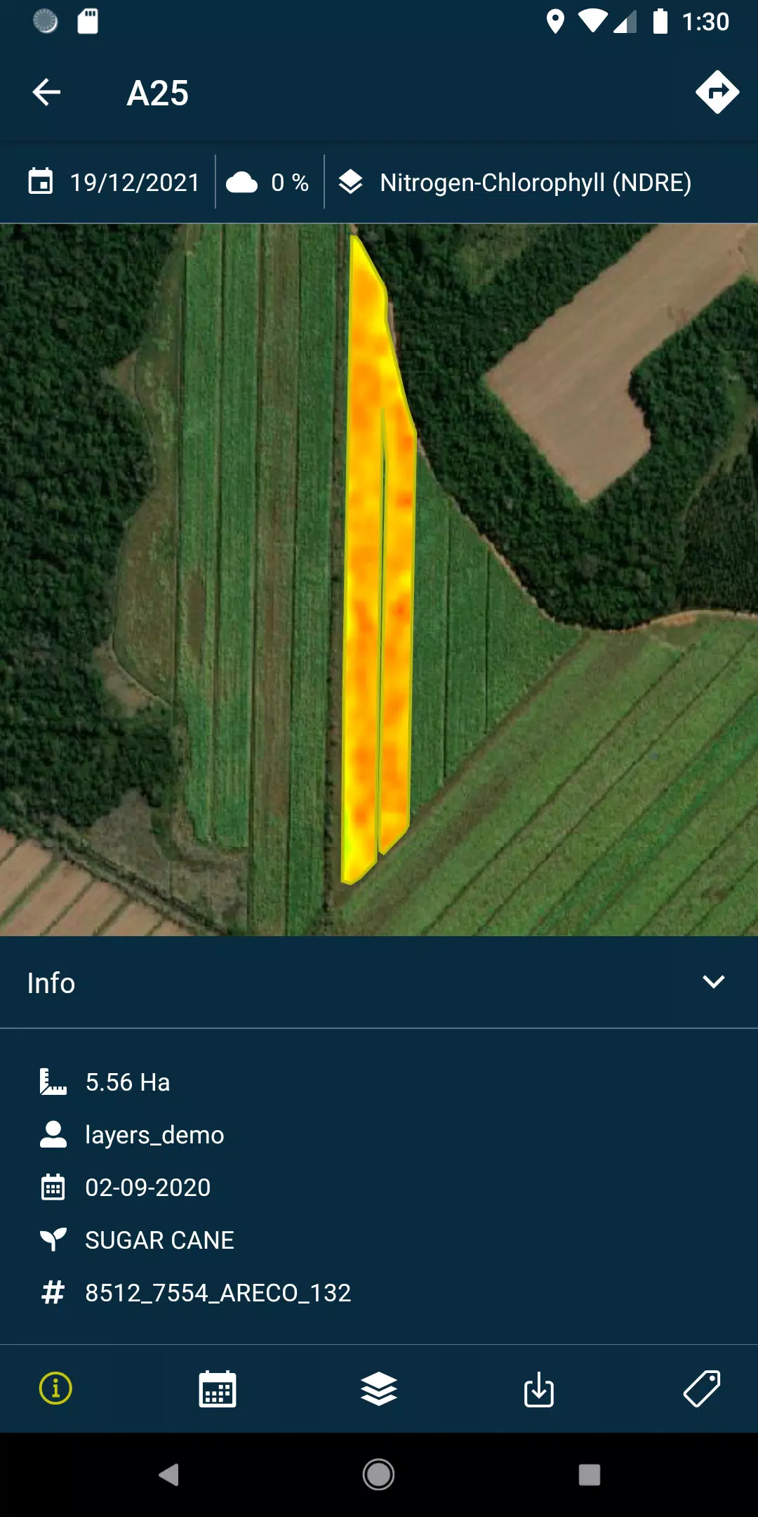
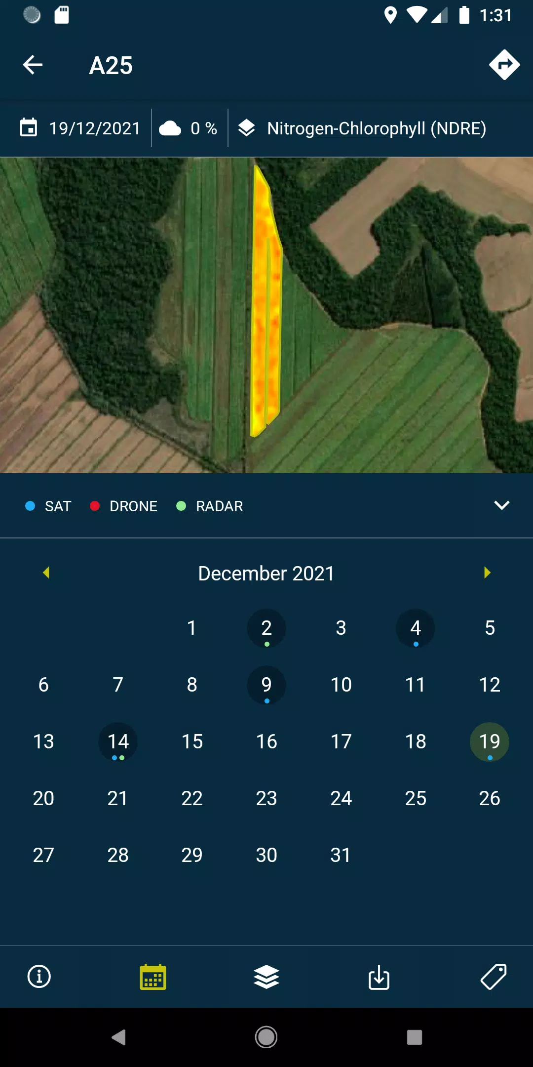
- Access layers (reports and recommendations) and view the PDFs generated from each drone flight or satellite pass, available both online and offline for your convenience.
- Capture field photos and geolocate them, along with the ability to add comments for meticulous field management.
- Conduct field surveys and upload them directly into the system for further analysis and processing.
Please note that a subscription to HEMAV products is required to utilize this app's full potential.
About HEMAV Precision Agriculture Service:
HEMAV's LAYERS software leverages Artificial Intelligence to provide the agricultural sector with precise agronomic recommendations. These insights help in optimizing treatments and generating accurate crop production estimates, focusing on both yield and quality.
What's New in Version 2.8.5
Updated on October 19, 2024, the latest version 2.8.5 includes important bug fixes that address issues with pending sample uploads and enhance cloud coverage filtering for more reliable data.