Zoom Earth stands out as a top-tier interactive weather map and real-time hurricane tracker, designed to keep you informed about hurricanes, typhoons, and tropical cyclones as they develop. With a suite of powerful features, Zoom Earth ensures you stay one step ahead of the weather.
Key Features:
Satellite Imagery: Experience the world's weather with near real-time satellite imagery sourced from NOAA GOES, JMA Himawari, EUMETSAT Meteosat, and NASA's polar-orbiting satellites Aqua and Terra. This comprehensive coverage ensures you get a global perspective on weather patterns.
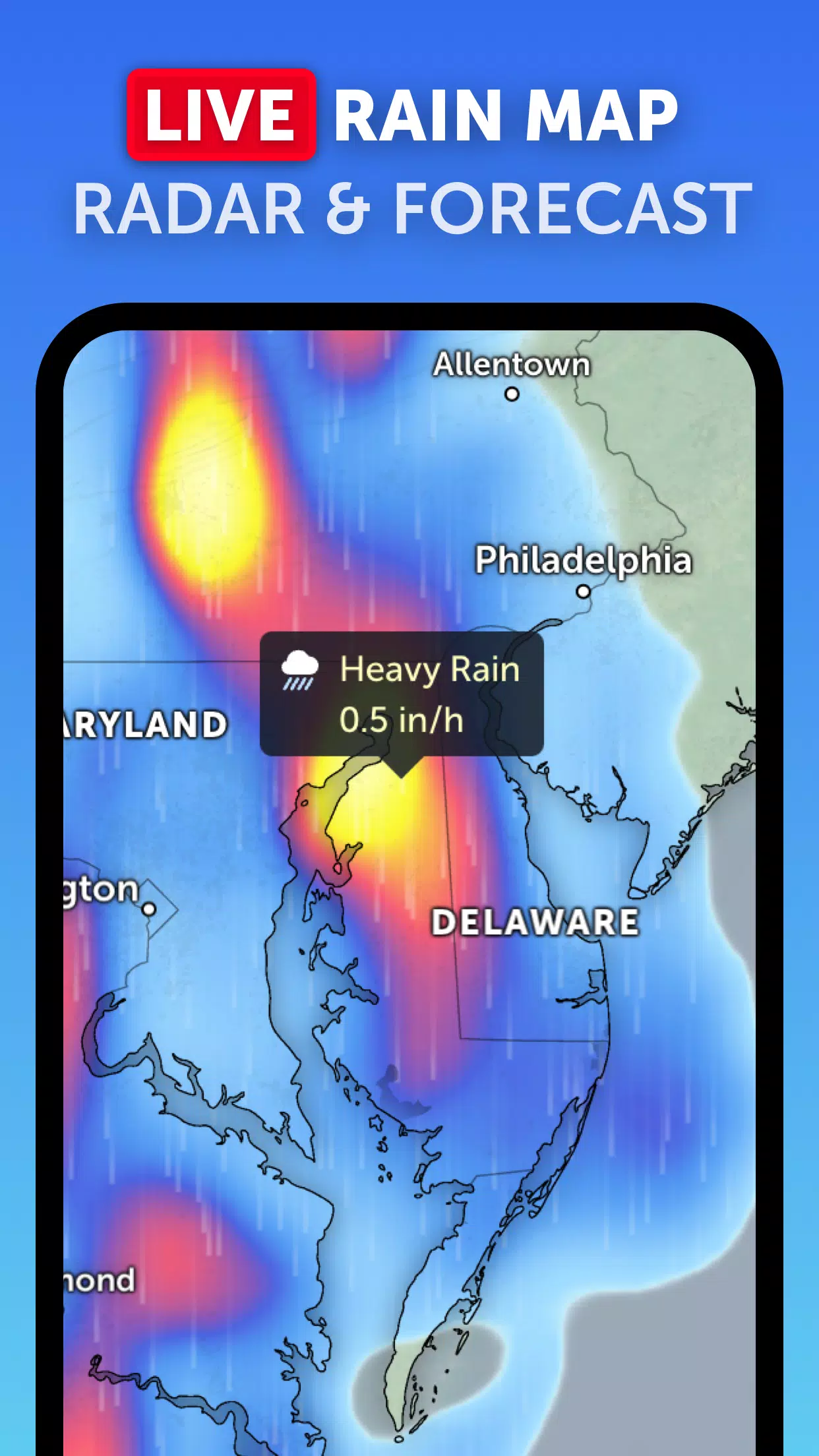
Rain Radar: Stay ahead of storms with our detailed weather radar map. It provides real-time detection of rain and snow using ground-based Doppler radar, helping you prepare for incoming weather events.
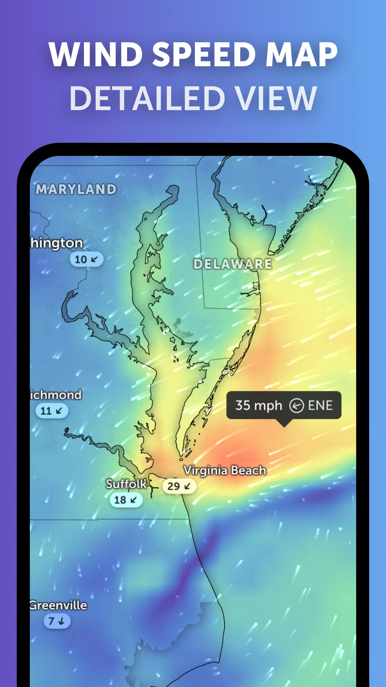
Weather Forecast Maps: Dive into visually stunning, interactive global forecast maps. These maps cover a wide range of weather data, including precipitation, wind speed and gusts, temperature, "feels like" temperature, relative humidity, dew point, and atmospheric pressure forecasts. This comprehensive data set helps you plan your activities with confidence.
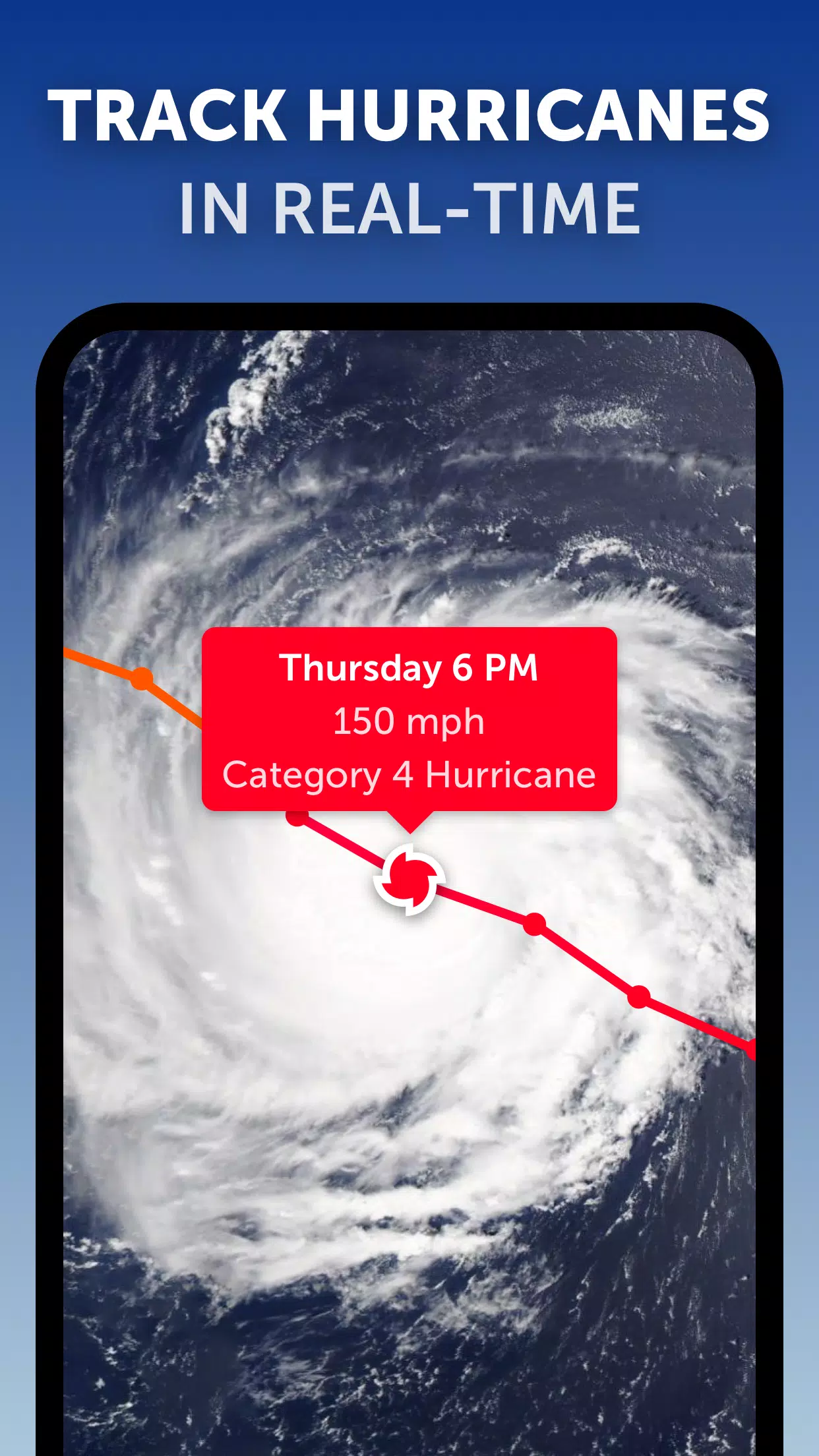
Hurricane Tracking: Follow the progression of hurricanes from their initial development to becoming powerful category 5 storms in real-time. Our state-of-the-art tropical tracking system integrates the latest data from the National Hurricane Center (NHC), Joint Typhoon Warning Center (JTWC), Naval Research Laboratory (NRL), and the International Best Track Archive for Climate Stewardship (IBTrACS), ensuring you have the most accurate and up-to-date information.
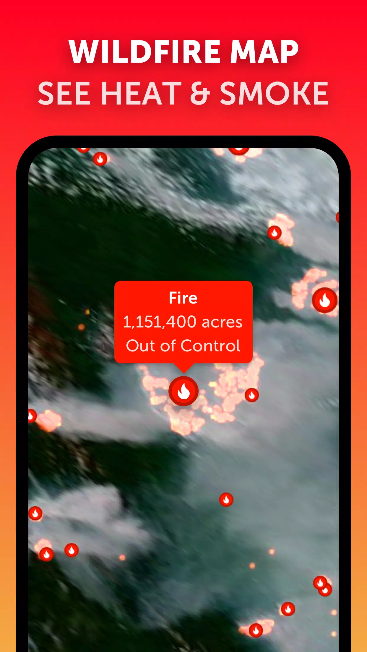
Wildfire Tracking: Stay informed about wildfires with our active fires and heat spots overlay. This feature uses daily updates from NASA's Fire Information for Resource Management System (FIRMS) to show points of very high temperature detected by satellite, helping you monitor the spread and intensity of wildfires.
Customization: Tailor your experience with our extensive settings. Adjust temperature units, wind units, time zone, animation styles, and more to suit your preferences and needs.
What's New in Version 3.1
Last updated on Sep 19, 2024
- Enhanced user experience when viewing multiple tropical systems by reducing clutter.
- Introduced separate alerts for Atlantic and Eastern Pacific systems to provide more targeted information.
- Improved map labels for better readability and navigation.
With these features and continuous updates, Zoom Earth remains your go-to resource for tracking hurricanes, typhoons, and tropical cyclones in real-time, ensuring you're always prepared for whatever the weather brings.